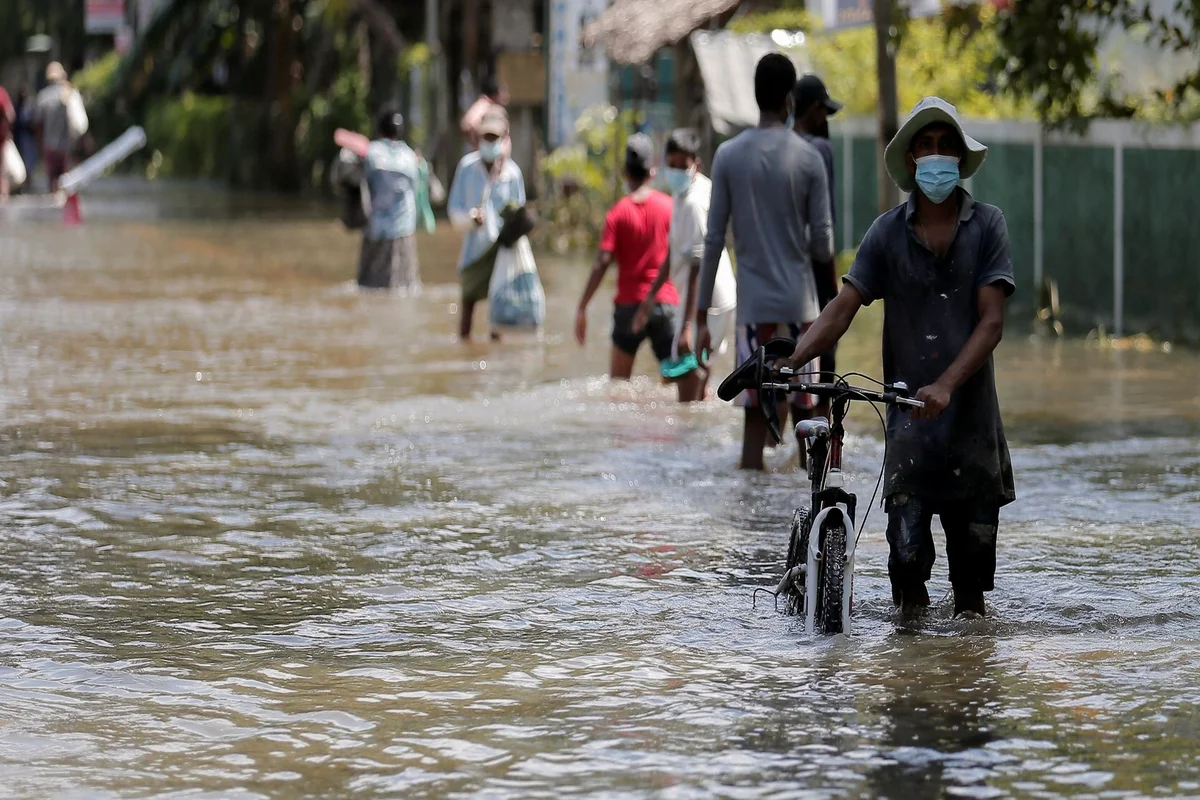
Weather Update: A low point pressure area is expected to form over the northwest Bay of Bengal around August 19, 2022, the regional center of the India Meteorological Department (IMD) said on Monday. For Nabarangpur, Nuapada, Balangir, Bargarh and Jhansuguda, a yellow warning for rainstorm has been issued. For August 16, Tuesday, there is no rain alert.
Meteorological Department said “Under the influence of a depression in North Chhattisgarh, squally surface wind speed reaching 40 to 50 kmph gusting 60kmph are very likely along and off Odisha coast and North adjoining West-central Bay of Bengal. Sea condition is likely to be rough to very rough during next 24 hours”.
“Fairly widespread/widespread light/moderate rainfall is likely over Gangetic West Bengal, Odisha, Jharkhand, Chhattisgarh and East Madhya Pradesh during 18th-19th August 2022. Isolated heavy to very heavy rainfall is likely over Odisha on the 18th & 19th of August,” the weather agency added.
Over the next 24 hours, the sea condition is likely to be rough to very rough over the north and adjacent west central Bay of Bengal, along with the coast of Odisha, before gradually getting better. Fishermen have been notified not to venture into sea and off the coast off Odisha, north adjoining the west-central Bay of Bengal, for the next 24 hours.
In the meantime, a flood-like situation has formed in Junagarh block in Kalahandi district as a result of the turbulent flow of water in Hati River due to intense rainfall.
Officials reviewed the Flood situation
Along with SRC P K Jena and other authorities, Odisha Chief Secretary Suresh Mahapatra evaluated the flood situation in the state today. Following the review meeting, the Chief Secretary made the call to shut 8 sluice gates of Hirakud Dam reservoir.
According to Chief Secretary Suresh Mahapatra, a medium-level flood may occur in the state, as a result of an increase in Mahanadi’s water level.
Mahapatra said, “We are regulating the water flow in the river and our officials have been put on high alert to meet any eventuality”.
By Saturday night, the Hirakud dam’s sluice gates had been opened up to 34 times. 8 of these gates were shut on Monday afternoon in an effort to control water evaporation from the reservoir and prevent flooding in the Mahanadi river basin downstream.
Also Read: Arvind Kejriwal slams PM Modi’s ‘Revdi’ remark
Section 144 enforced at Maa Bhattarika temple in Cuttack
Meanwhile, the district government imposed prohibitory orders under Section 144 at the Maa Bhattarika temple in Cuttack, which has been inundated by floodwaters since the Mahanadi river passed the danger mark near Naraj.
After locals gathered to see flooding in the temple’s sanctum sanctorum, the prohibitive orders were put in place. Due to strong river currents, access to the temple grounds has been prohibited.
Near Naraj, the Mahanadi was flowing at 26.68 metres, which was above the danger level of 26.41 metres. According to officials, around 10.50 lakh cusecs of floodwater is being released to Mahanadi through Khairamal while 8.58 lakh cusecs of water is flowing in the river at Mundali barrage.
The official added, “We are expecting a flow of around 10 lakh cusecs of floodwater through Mundali barrage in the next few hours”.
Also Read: Railway updates: 27 partially and 87 fully cancelled trains today, list here
Thuamul Rampur in Kalahandi district recorded highest rainfall of 368mm. Due to extremely intense rainfall, 7 places in Odisha recorded a rainfall of 200mm and above. 43 places recorded rainfall between 115mm and 200mm.
Several low-lying homes have been affected by flooding. According to Suresh Mahapatra, wherever there is a threat, people would be evacuated to safer areas.
Keep watching our YouTube Channel ‘DNP INDIA’. Also, please subscribe and follow us on FACEBOOK, INSTAGRAM, and TWITTER.


